
Our heritage
Data on Côte d’Ivoire
Côte d’Ivoire is a West African country and a member of the African Union. With a surface area of 322,462 km2, it is bordered to the north by Mali and Burkina Faso, to the west by Liberia and Guinea, to the east by Ghana and to the south by the Atlantic Ocean. The population is estimated at 28 million in 2022.
The political and administrative capital of Côte d’Ivoire is Yamoussoukro (Abidjan remains the economic capital), the official language is French and the currency is the CFA franc.
The country is a member of ECOWAS. Initially a French protectorate in 1843 and a French colony in 1893, the country gained independence on 7 August 1960 under the leadership of Félix Houphouët-Boigny, the first President of the Republic.
The economy, essentially based on coffee and cocoa production, experienced exceptional growth over the first two decades, making Côte d’Ivoire a leading country in the West African sub-region. French is the country’s official language. Around 70% of the country’s inhabitants understand and speak it. Located between 4° and 10° north latitude, Côte d’Ivoire is approximately 400 km from the equator on its southern margins and approximately 1,400 km from the Tropic of Cancer on its northern borders. The climate, which is generally hot and humid, is therefore a transition between equatorial and tropical.
Equatorial along the coasts, it is semi-arid in the far north. Temperatures fluctuate around 28°C on average. There are two main climatic zones: the equatorial climate and the tropical savannah climate, which is itself more or less dry. The short dry season covers the months of August and September. The rainy season lasts from May to July and the short season from October to November.
The tropical humid savannah climate covers the north of the southern forest zone and the south of the savannah region. Temperatures range from 14°C to 33°C, with humidity of 60% to 70% and annual rainfall of 1,200 mm3 in Bouaké. This climatic region also has four seasons: two dry seasons, from November to March and July to August, and two rainy seasons, from June to October and March to May. The dry savannah climate is found mainly in the Savanes region.
Daily and annual temperature variations are relatively wide, around 20°C, and the humidity level, lower than in the south of the country, varies from 40% to 50%. The area is characterised by the intermittent presence of a cool, dry harmattan wind between December and February. There are two seasons: a dry season from November to June, punctuated by a few rains in April, and a rainy season from July to October.
The average rainfall recorded in Korhogo is 1,203 mm3. Physical geography Côte d’Ivoire is shaped like a quadrilateral, with 520 km of coastline on the Atlantic Ocean to the south, in the western part of the Gulf of Guinea. The country has a low relief. Most of the land is made up of plateaux and plains.
The western part of the country is mountainous, but there are a few peaks above a thousand metres (Mount Nimba rises to 1,752 m). Outside this region, altitudes generally vary between 100 and 500 m, with most plateaux at around 200-350 m. The dominant feature of these plateaux is a ferruginous cuirass visible on the surface in the form of rust-coloured slabs, but sometimes veiled by sand, gravel or finer products.

ENVIRONMENTAL PROTECTION

The Government is very concerned about the environment. It is no longer just a question of giving holidaymakers the pleasure of seeing animals in their natural environment that they only know from zoos.
It was with this in mind that the eight national parks, six nature reserves and 16 botanical reserves were created, with the aim of protecting not just wildlife but the environment as a whole. The policy of creating protected areas – national parks and reserves – goes back a long way. In 1926, on the outskirts of Abidjan, a forest reserve was created, the Banco Park.
In 1953, it was classified as a national park and the same year, in the Bouna region in the north-east, 1,150,000 hectares were set aside as an animal reserve, the “Bouna Reserve”, which was transformed into the Comoé National Park in 1968. The Taï National Park covers 335,000 hectares. Its main attraction is Mount Nienokoué, which extends northwards into the Nzo Reserve. Its main mission is to conserve the last remnants of the primary forest, rich in endemic species. It is not open to the public, nor is the Éhotilés islands reserve, located in the Aby lagoon to the east of Abidjan.
This park, created in 1974, was entrusted to the Ministry of Education for historical and archaeological research. Surrounded by 60% water, Azagny National Park, near Grand-Lahou, borders the lagoon. It is mainly a marshy savannah with palm trees, home to elephants, monkeys, buffalo, etc. The Mont Péko park, a few kilometres from Duékoué, is renowned for its vegetation (mountain flora and some remnants of primary forest).
Its peaks exceed 1,000 metres and offer magnificent views. In the centre of the country, the Marahoué park stretches over 101,000 hectares above the road linking Bouaflé and Daola. A little further north, in the Haut-Bandama wildlife reserve, you can still see elephants, duikers, buffalo and primates. In the centre-west, the Mont-Sangbé National Park, between Sassandra and the Touba-Biankouma road, is part of the central zone of the Man massif. The Mont-Nimba integral nature reserve, on the Guinean border, is almost 1,300 metres high and boasts a highly diverse entomological fauna.
A MELTING POT OF COMMUNITIES
With a population of almost 29 million, Côte d’Ivoire has more than sixty ethnic groups. An ethnic group can be defined as a community with a common ancestry, traditions, beliefs and language. On this basis, there are five main groups: the Malinké, the Gurs, the Mandés-Sud, the Krous and the Akans. The Malinké, who come from the banks of the Niger, have divided into two groups, one in the north-west, occupying the region from Odienné to the borders of Mali and Guinea. The other extends east of the Niakaramandougou-Ferkessédougou road. They are known as the “Dioula group” (pronounced “djoula”), which does not indicate their origin, but their profession. The word dioula means “trader”. These were Malinke merchants who spread throughout the Centre and around Bondoukou in the north-east. The Gur group includes the Sénoufos, who lie between the two Malinké groups, the Koulangos and the Lobis, who succeed one another or live side by side in the north-east, along the borders with Burkina Faso and Ghana.
In the west, to the south of the Malinké group, are the Mandés-Sud. They include the Dans (or Yacoubas), the Gouros or Kouenis and the Gagous. The name Mandé, sometimes given to the Malinké, suggests a vague kinship between them. However, they have nothing in common, neither their physical appearance, nor their religion, nor even their origin. Many specialists now consider the South-Mande to be probably indigenous.
The Krous, in the South West, come from English-speaking Liberia. In fact, in the Tabou region, on the coast, some people are called Krumens. They include the Guérés, the Wobés, the Niabouas, the Neyos, the Bétés, the Godiés and the Didas. But the origin of the Didas seems rather mysterious. They are very different from the other Krous in their beliefs and customs. The Adioukrous, who claim to have come from the west, consider themselves to be cousins of the Didas, although ethnologists believe them to be indigenous. The Lagoon Akans arrived in several waves from south-east Ghana. This group includes Abés, Attiés, Abourés, Tchamans (Ebriés), Brignans, Alladians, Nzimas (Appolonians), Abis and Fantis. Finally, also from Ghana, other Akans came later, such as the Abrons and the Agnis (or Anyis), who spread out along the Ghanaian border from Bondoukou to Aboisso. The Baoulés, who belong to the Akan group of Ashantis, live mainly in central Côte d’Ivoire, where they are in contact with the Gouros to the west and the Gagous to the south. Apart from this classification, which is very schematic, other ethnic groups have mixed with the previous ones or still exist in very small nuclei, particularly in the mountains of the west or in the forests. It is clear that there has been a major mixing of populations, especially in recent decades and in the large towns. The creation of the Kossou dam led to an exodus of farmers displaced by the waters to the sparsely populated south-west region. However, customs and traditions have survived to the present day, forming an immensely rich cultural heritage.

PROTECTED AREAS

Côte d’Ivoire is home to 231 classified forests with a total surface area of 4,200,000 ha, 8 national parks (1,732,100 ha), 6 nature reserves (339,630 hectares) and 16 botanical reserves (198,418 hectares).
In addition to these in situ conservation sites – protected areas and classified forests in each of the country’s ecological zones – there are 6,702 sacred forests (36,436 ha), which are areas reserved for religious rites and to which access is highly selective. Six protected areas are listed under the Ramsar Convention, three are UNESCO World Heritage sites and two are biosphere reserves.
NATIONAL PARKS
– Asagny National Park (19,400 ha): 100 km from Abidjan at the mouth of the Bandama river.
– Banco National Park (3,200 ha): right in the heart of Abidjan.
– Comoé National Park (1,150,000 ha): in the north-east of the country.
– Îles Éhotilés Marine Park (500 ha): near Adiaké, on the Aby lagoon to the east of Abidjan. The park, created in 1974, covers six islands: Monobahas, Niamoan, Bitouaté, Élouamé, N’Gremon and Bossou Assouan.
– Marahoué National Park (101,000 ha): to the south-west of Lake Kossou, in the Bouaflé region.
– Mont Péko National Park (34,000 ha): a few kilometres from Duékoué, north of Lake Buyo.
– Mont Sangbe National Park (95,000 ha): north of Man and west of the Sassandra river, straddling Biankouman and Touba.
– Taï National Park (35,000 ha): near the border with Liberia, south of Guiglo and around 100km north of Tabou. It has been classified as a World Heritage Site.
WILDLIFE RESERVES :
– Abokouamékro wildlife reserve (21,000 ha): 60 km from Yamoussoukro.
– Haut Bandama wildlife reserve (123,000 ha): north of Katiola.
– N’zo Wildlife Reserve (96,000 ha): to the north of the Taï National Park.
STRICT NATURE RESERVES :
– Mont Nimba (5,000 ha): to the west of Man.
– Lamto (2,585 ha)…

The 14 autonomous districts

Autonomous District of Abidjan
Located in the south of the country, bordering the Atlantic Ocean, precisely in the Gulf of Guinea, the Autonomous District of Abidjan covers an area of 2,119 km2.

Autonomous District of Bas-Sassandra
The Autonomous District of Bas-Sassandra is located in the southwest of the country, bordering Liberia to the west, between the Montagnes District to the northwest, the Sassandra-Marahoué District to the north, the Gôh-Djiboua District to the east, and the Gulf of Guinea to the south. Its district capital is San-Pedro.

Comoé Autonomous District
The Autonomous District of Comoé comprises three regions, namely the Indénié-Djuablin Region, the Moronou Region and the Sud-Comoé Region. It covers an area of 20,353 km2.

Autonomous District of Denguélé
The Denguélé Autonomous District has the town of Odienné as its capital. It is located in the northwest of Côte d’Ivoire, bordered by the Savanes and Woroba Autonomous Districts, Mali, and Guinea.

Autonomous District of Goh-Djiboua
The Autonomous District of Gôh-Djiboua has the city of Gagnoa as its capital. It extends over the southern and south-central parts of the country, and includes the regions of Gôh and Lôh-Djiboua.

Autonomous District of Lakes
The Autonomous District of Lakes, whose capital is Dimbokro, the former capital of the cocoa belt, includes the regions of N’zi, Bélier and Iffou.

Autonomous Lagoon District
The Lagunes Autonomous District is located in the south of the country, between the Gulf of Guinea and the Autonomous District of Abidjan to the south, the Districts of Bas-Sassandra and Gôh-Djiboua to the west, the Lakes District to the north, and the Comoé District to the east. Before the administrative redistribution, there was a Lagunes region.

Autonomous District of the Mountains
The Autonomous District of the Mountains has as its capital the city of Man. This district extends to the west of the country and includes the regions of Tonkpi (in the north), Guémon (in the center-east) and Cavally (in the south).

Autonomous District of Sassandra-Marahoué
The Autonomous District of Sassandra-Marahoué is a District of Ivory Coast, in West Africa, whose capital is the city of Daloa.

Savanes Autonomous District
The Savannah Region, later the Savannah Autonomous District, is located in the north of Ivory Coast, close to Mali and Burkina Faso. Its capital is the city of Korhogo.

Bandama Valley Autonomous District
The Bandama Valley District has the city of Bouaké as its capital. It covers an area of 28,530 km2.
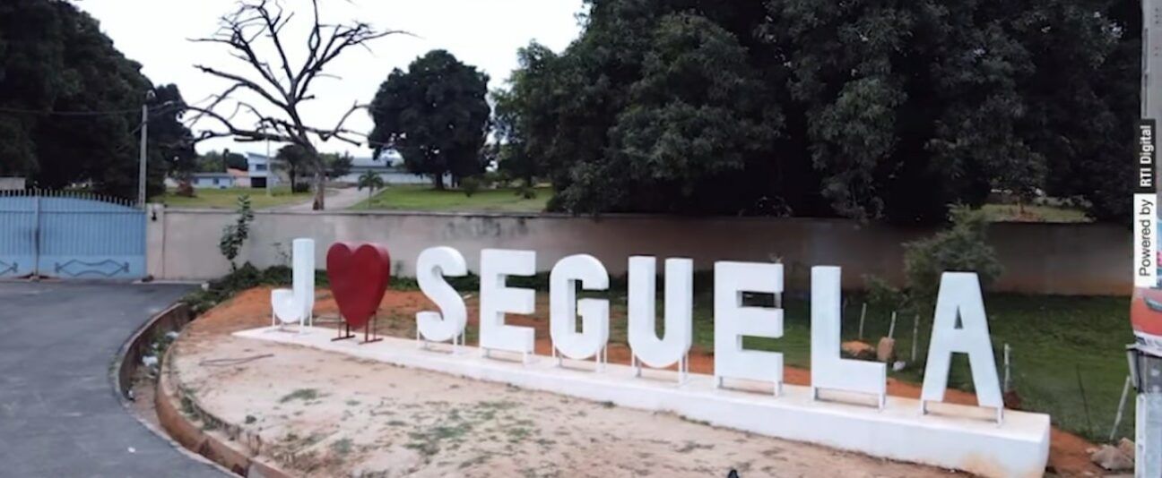
Autonomous District of Woroba
The Woroba District has the city of Séguéla as its capital. This district is located in the northwest of the country, surrounded by the districts of Savanes, Denguélé, Montagnes, Sassandra-Marahoué, Vallée du Bandama, and Guinea.

Yamoussoukro Autonomous District
A territorial community of a particular type, the Autonomous District of Yamoussoukro covers the territory of the current department of the same name. Located between 06° 49 and 06° 47 North latitude and 05°16 and 05°15 West longitude, it covers an area of 3,500 square kilometers.

Autonomous District of Zanzan
The Zanzan District has the city of Bondoukou as its capital. It corresponds to the former Zanzan region. The district is located in the northeast of the country and borders the republics of Ghana (to the east) and Burkina Faso (to the north).